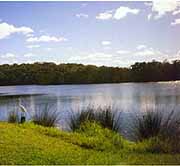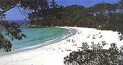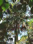
Welcome to the natural and protected beauty of the National Parks of the Shoalhaven area. |
Morton National Park | ||
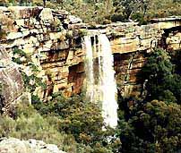
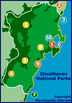
A wild national park, the Morton is home to the famous Pigeon House Mountain and Fitzroy Falls amongst many other spectacular features. The sheer size and ruggedness of the Morton National Park make it popular with serious bushwalkers though easy walks are also available. The most remote reaches include declared wildernesses and evocatively named points such as Shrouded Gods Mountain, the Byangee Walls, The Castle and more. Photography and camping are also popular. Exploration of this park should only be done with proper preparation including provisions, maps, weather and road advice, and after informing someone of your plans and expected day and time of return. [ Map ] |
Budderoo National Park | ||
Home to the popular Minnamurra Rainforest, the Budderoo National Park is at the northern tip of the Shoalhaven. The Minnamurra Rainforest Centre includes visitor information and is operated along with guided tours and a cafe. A raised boardwalk with disabled access winds through the rainforest. Minnamurra Falls are accessible via a paved track. Park fees and time restrictions apply. [ Map ] |
Seven Mile Beach National Park | ||
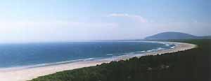
Self descriptive, this park runs in a narrow coastal strip from Gerroa south to Shoalhaven Heads. The magnificent sweeping beach seems to go forever and water sports are popular especially body and board surfing. The main visitor destination at Beach Road provides easy access with a new board walk to the beach and viewing platform with views along the length of the beach. There is wheelchair access to the lookout platform and to the end of the board walk. BBQs and tables are provided in the large and shady picnic area which is adjacent to the beach area. Walkers can explore the forest on trails behind the dunes. Please remember that the dunes are very fragile ecosystems and so only use the paths provided to get to and from the beach. [ Map ] |
Budawang National Park | ||
Rugged and remote this is another park for the serious. Joining the Morton National Park, the Budawang is only accessible to walkers via the Kings Highway between Batemans Bay and Canberra. The Budawang Range is spectacular with sculptured rock faces and mesa like peaks. Most of this park has been declared wilderness area including the Ettrema Wilderness. The Budawang National Park has many significant Aboriginal sites including paintings and drawings in rock shelters. It is also home to many threatened native plants and animal species. [ Map ] |
Booderee National Park | ||
One of Australia's most precious, Booderee National Park is the former Commonwealth park known as the Jervis Bay National Park and is managed by the Wreck Bay Aboriginal Community and the Australian Nature Conservation Agency. Booderee National Park also encompasses the Booderee Botanic Gardens and adjoins the NSW Jervis Bay National Park. The name Booderee is a local Koori word meaning bay of plenty (fish). Many visitor facilities are available and park use fees apply. Visit the comprehensive Booderee website for more information. [ Map ] |
Jervis Bay Marine Park | ||
The Jervis Bay Marine Park is administered by the Marine Parks Authority and jointly managed by the NSW National Parks and Wildlife Service and NSW Fisheries. The crystal clear waters and the world's whitest beach sands provide a picturesque setting for the diverse range of aquatic and terrestrial ecosystems of Jervis Bay. The marine life in the bay is particularly rich. A resident pod of dolphins is enjoyed by visitors. Diving is very popular. Picnic areas, walking tracks and information signs are provided. [ Map ] |
Murramarang National Park | ||
The Murramarang National Park is situated at the southern end of the Shoalhaven area. It includes coastal pockets running from Pretty Beach to North Durras and from South Durras to North Head at Batemans Bay and also a precious area bordering Durras Lake. This park's most famous asset is Pebbly Beach, where kangaroos have been known to enter the water. Generally these roos lounge around welcoming their visitors. Also included in Murramarang are 4 islands. Many walking tracks are marked throughout the park and accommodation is available in a variety of styles including camping and cabins. [ Map ] |
Cudmirrah National Park | ||
The Cudmirrah National Park wraps around the shores of coastal Swan Lake between Sussex Inlet and Lake Conjola. Other popular spots and features include the Monument Beach picnic area and Fishermans Rock via Berrara. There are both short and long walks to enjoy. Bird watching is particularly favoured by visitors with over 160 species of birds, some threatened, either frequenting or resident in the park. Native wildflowers including waratahs and orchids are enjoyed in spring in this small but diverse park. [ Map ] |
Conjola National Park | ||
Another small but precious park, Conjola National Park extends from the western and northern shores of Lake Conjola just north of Ulladulla in the southern Shoalhaven. Eucalypt forests rise from the shores of the lake and the hilly terrain rises to Mt Conjola, 120 metres above sea level. Fishing and boating are the most popular activities on and around Lake Conjola with most visitors accessing the park by boat. No facilities are yet provided at this relatively new park which was gazetted, along with Cudmirrah National Park, in 1994. [ Map ] |
NSW Jervis Bay National Park | ||
Adjoining the Booderee National Park and the Jervis Bay Marine Park, the NSW Jervis Bay National Park is also rich in Aboriginal history, flora and fauna. The walking track between Greenfield and Hyams Beaches has information signs describing the links between plants, animals and landscape of this spectacularly beautiful area. Access to the NSW Jervis Bay National Park is via the coastal township of Vincentia. [ Map ] |